Drone App: Forecast for UAV
- 4.3
- Rating
- 1.00M
- Installs
- Free
- Price
 Analysis by App-foxy
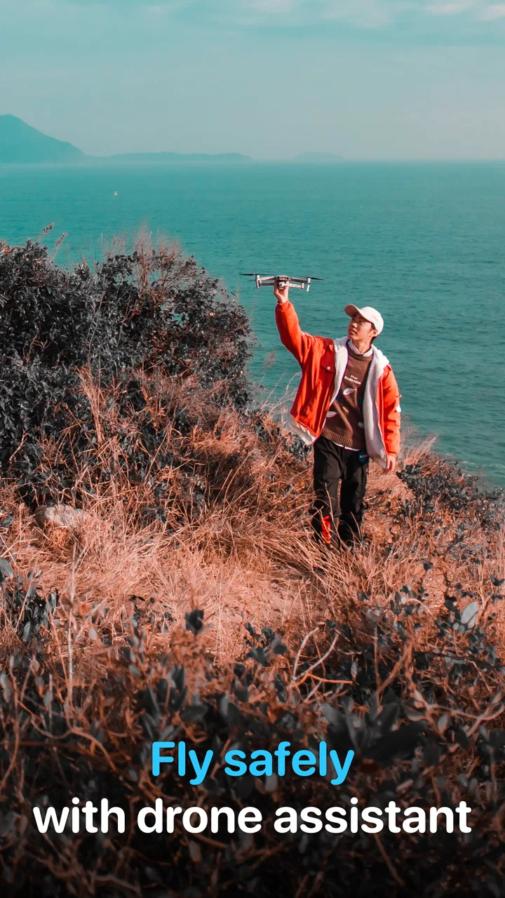
If you fly a quadcopter, ordinary weather apps often leave you doing too much guesswork. They may show rain and temperature, but they are not always arranged around the practical question a pilot asks before takeoff: is this a sensible time and place to fly? Drone App: Forecast for UAV is built for that decision. I found it most useful as a focused weather companion for drone planning, especially when I wanted a quick view before taking equipment outside rather than a general forecast full of unrelated information.
The app comes from Go Dreams and is available as a free weather app for everyone. It has passed the early “is this worth trying?” stage with more than a million installs and an average rating of 4.3 from roughly 33 thousand ratings. That does not make it automatically right for every pilot, but it does suggest that the basic idea is easy for many people to understand. The current version is 1.5.9, and it works on devices running Android 6.0 or later.
From installation to a useful pre-flight decision
I treat installation as the start of a small planning routine, not as a shortcut to a yes-or-no flight verdict. I would first pick a familiar launch area, check the forecast before packing, then revisit it before leaving so a changing plan does not catch me off guard. That routine also makes it easier to see where the app helps—and where I still need other checks.
You May Also Like

 Blood Strike: 2.5 Anniversary
Blood Strike’s Loadouts Turn Every Drop Into a Tactical Gamble
A close look at Blood Strike’s custom loadouts: how fast access to signature weapons reshapes its battle royale rhythm, rewards preparation, and narrows the gap between fights.

 Pandora - Music & Podcasts
Pandora’s Music Is Easy to Start, but Harder to Recover
Pandora’s strength is its low-effort path from a seed to a station. Its weak spot is how much confidence it asks you to place in connection, setup, and quiet recovery.

 8 Ball Pool
 Is Built on Rivalries, Rematches, and Routine
A close look at the rivalries, rematches, shared routines, and unanswered safety questions that turn a quick pool match into a persistent mobile community.

 Samsung Music
’s Quiet Strength Is Playing What You Already Own
Its reach comes less from spectacle than from dependable access to a personal library. That simplicity is both the app’s strongest retention engine and its ceiling.

 AccuWeather: Weather Radar
AccuWeather Review: A Quick, Clear Forecast for Everyday Decisions
For everyday plans, the best forecast is the one you can understand quickly. AccuWeather makes rain timing, radar, and local conditions easy to act on, with a few trade-offs.

 Hill Climb Racing
Why Hill Climb Racing Still Turns Crashes Into One More Run
A tiny car, a bumpy hill and one more upgrade: Hill Climb Racing keeps resurfacing because its simple chaos makes every near-miss feel personal.
More From Our News Desk



What to expect when you open it
The central purpose is straightforward: use a weather forecast and an air map to help decide whether a drone flight is sensible. The store summary presents it as an app to use before flying a quadcopter, with particular relevance to DJI pilots. I would not treat that wording as a promise that the app replaces official aviation information, local rules, or the drone manufacturer’s own guidance. Instead, I see it as a planning layer that helps turn weather information into a more pilot-friendly check.
That distinction matters for first-time users. A forecast can be encouraging while the actual flight is still unsuitable because of local restrictions, obstacles, poor visibility, a crowded area, or conditions that change faster than expected. I use this app to answer the first screening question, not the entire safety question. Its best role is a pre-flight filter, not a substitute for responsible flight preparation.
The free entry point makes it easy to test without committing money immediately. In-app purchases range from $2.49 to $24.99 per item, so I would look carefully at what any optional purchase changes before confirming it. A casual pilot who flies occasionally may be completely satisfied with the initial experience, while someone who plans flights frequently may find extra options more worthwhile. The important point is to judge those additions against your actual routine rather than assuming every paid item is essential.
Setting it up without overthinking the first launch
My advice is to begin with one simple location: the place where you most often launch. Do not start by trying to plan a complicated trip across several possible flying areas. The first useful test is much easier. Open the app, identify your current or intended flying area, and inspect the forecast there before worrying about advanced planning habits.
When an app combines a map with weather information, new users can sometimes mistake visual detail for a complete flight authorization check. I would keep two separate questions in mind. First, is the weather reasonable for the aircraft and the pilot? Second, is the location appropriate and permitted? The weather-focused answer can help with the first question, but you still need to handle the second through the relevant local sources and your own knowledge of the area.
For a first session, I would also compare what the app shows with the conditions outside your window. This is not a scientific accuracy test, but it is a practical orientation exercise. If the screen suggests a comfortable flying period, look at the sky, nearby trees, visibility, and the way conditions are changing. That habit prevents the common mistake of trusting a forecast more than direct observation.
Another useful setup habit is to check the app before your equipment is packed. If you wait until you are already at the launch site, a disappointing forecast can turn into wasted travel and a rushed decision. I prefer checking at home, then checking again shortly before leaving. The first look helps choose a time; the second confirms that the plan still makes sense.
Your first successful action: plan one short flight window
A meaningful first success is not simply opening the map. It is using the information to make a clear decision. Choose a familiar location and a modest flight plan, then use the app to identify a weather window that looks suitable. If the conditions appear poor, the successful action may be deciding not to fly. That is still useful: the app has done its job if it prevents an avoidable trip or an unnecessarily risky launch.
For example, imagine I want to take a few landscape photographs on a free afternoon. I would check the intended area before charging every battery and loading the car. If the forecast looks unsettled, I might delay the outing rather than arrive with a fixed expectation. If it looks promising, I would still keep the first flight conservative, stay close to the planned area, and reassess the sky and surroundings when I arrive.
This workflow is especially helpful for beginners because it creates a repeatable routine:
Choose the location before choosing the flight time.
Use the weather view to find a reasonable window instead of assuming the whole day is equally suitable.
Check the actual surroundings when you arrive.
Keep the first flight simple enough that changing conditions do not leave you committed to a long route.
The non-obvious benefit is that the app can improve restraint. New pilots often focus on whether they can technically launch, while experienced planning asks whether the flight is worth starting at all. A focused forecast makes that pause easier. It also gives you a reason to build a habit around conditions rather than relying on a quick glance at the sky.
How the map fits into the decision
The air-map aspect is valuable because a drone flight is tied to a place, not just a general regional forecast. A broad weather app may tell me that my city is dry, but that does not automatically describe the open field, shoreline, or hillside where I intend to fly. A map-oriented view encourages me to think about the exact area instead of treating a large town or county as one uniform environment.
I would use the map to narrow the planning area, then combine it with what I already know about the site. Look for practical complications that a weather screen cannot settle on its own: people arriving, trees moving differently at ground level, buildings creating awkward launch conditions, or a route that becomes difficult to monitor. The map helps organize the location decision, but it does not remove the need for judgment.
For DJI pilots, the app’s positioning is naturally appealing because it speaks directly to a common drone workflow. Still, I would not assume that a DJI-oriented description means every aircraft-specific detail is handled for every model. If your flight depends on a particular aircraft limitation, battery behavior, controller warning, or manufacturer setting, I would check the official documentation as well. The app is strongest when it complements those sources rather than trying to replace them.
Common confusion: weather suitability is not permission to fly
The most important misunderstanding to avoid is reading a favorable forecast as a green light for the entire flight. Weather is only one part of the decision. A clear-looking period can still be unsuitable if visibility is poor, the area is busy, or the location has restrictions. Conversely, a forecast that appears uncertain may still be manageable for a short local flight, depending on the aircraft, the pilot’s experience, and the conditions actually observed.
I also would not reduce the forecast to rain alone. Wind, changing conditions, visibility, and the difference between conditions at home and at the launch point can all affect the result. A drone may be able to take off in weather that is not sensible for a comfortable or controlled flight. The app helps bring weather into the foreground, but the pilot still has to interpret it in relation to the aircraft and the planned activity.
Another source of confusion is the difference between a forecast period and a guarantee. Forecast information is useful for choosing when to try, not for promising that every minute will remain identical. If I am planning a longer outing, I want a fallback plan: a shorter route, a nearby place to land, or a willingness to pack up. This is one reason I prefer using the app before leaving and again immediately before launch.
New users may also wonder whether a general weather app is enough. Sometimes it is. If you only fly rarely, stay in familiar places, and already have a reliable way to check local restrictions, a standard forecast may cover much of your need. The advantage here is concentration: the app puts drone-oriented planning and a location-based view closer together. That saves mental switching, but it does not necessarily provide more value for someone who never plans flights around weather.
Where it is stronger than ordinary weather apps
Compared with a typical weather app, this one is more relevant at the moment when I am deciding whether to fly a quadcopter. A general app is designed for walking, commuting, travel, and daily life, so its presentation may be broader than a pilot needs. Drone App: Forecast for UAV feels more purposeful when the question is tied to a launch area and a flight plan.
That focus can make a difference for beginners. Instead of asking, “What is the weather today?” I can ask, “Does this place look suitable for the flight I have in mind?” That is a better question because it connects the forecast to an action. It also encourages a more disciplined routine than checking a temperature icon while already standing beside the aircraft.
The trade-off is that a specialized app may become one more tool to consult. I would not delete every other source after installing it. For serious or unfamiliar flights, I still want official local information, the aircraft’s own status and warnings, and direct observation. The app earns its place by making the weather part of that process easier, not by making the rest unnecessary.
Three practical habits that make it more useful
First, use it to compare possible times rather than checking only the exact moment you hope to launch. If the afternoon looks questionable but an earlier window appears calmer, that can change the whole outing. This is more useful than treating the forecast as a yes-or-no label because it turns the app into a scheduling aid.
Second, use the map before selecting a launch point, not after. A common beginner habit is to choose a favorite open space and then ask whether the weather works there. I prefer starting with the intended area and considering whether another nearby location would make the same flight easier to monitor and safer to abort. The app cannot make that choice for me, but its location-centered design supports the order of thinking.
Third, record your own observations mentally after each flight. If the forecast looked comfortable but the site felt gusty, note that for the next visit. If a predicted poor period turned out to be calm enough for a short flight, remember the difference without treating it as proof that forecasts are useless. This personal feedback loop helps me interpret the app more intelligently over time.
A fourth habit is to avoid planning the most ambitious flight on the first day you use it. Start with a familiar location and a short objective. That gives you time to understand how the information fits your own aircraft, local terrain, and comfort level. It is a calmer way to learn than testing the app during a distant trip where every decision feels urgent.
Who should install it, and who should skip it
I think it is a good fit for new quadcopter owners who want a clearer pre-flight routine, occasional pilots who need a quick location-based weather check, and DJI users looking for a tool framed around their flying activity. It is also useful for people who tend to make decisions at the last minute and would benefit from checking conditions before loading their gear.
I would be more cautious about recommending it as the only planning tool for professional operations, unfamiliar airspace, or flights where a small change in conditions has serious consequences. Those users need a broader process that includes official restrictions, site assessment, aircraft-specific information, and appropriate operational planning. This app can sit inside that process, but it should not be mistaken for the whole process.
It may also be unnecessary for a person who never flies a drone. The app’s value comes from connecting weather and place to quadcopter use; if you only want a forecast for commuting or weekend walks, a conventional weather app will probably feel more natural. Likewise, pilots who already have a trusted planning system may find the extra installation adds little unless they specifically want this style of drone-focused view.
Value, age suitability, and the final learning curve
Because the app is free to install and rated for everyone, it is approachable for families, beginners, and casual users. That does not mean every flight is suitable for every age or experience level. A younger user can explore the forecast, but an adult or responsible pilot should still handle the legal, environmental, and safety decisions surrounding an actual flight.
The optional purchase range deserves a measured approach. I would use the free experience first and only consider paying after I knew which part of the workflow I wanted to improve. If the app becomes part of every flight plan, a paid option may feel reasonable. If I fly twice a year, spending money may not change the outcome enough to matter. This is a practical case where the right value depends more on frequency than on the headline price.
In daily use, the learning curve is less about pressing the right button and more about interpreting the information responsibly. The first successful session should leave you with a simple answer: fly, postpone, or investigate further. Once that habit is comfortable, you can use the app as a faster checkpoint before more detailed preparation.
My recommendation after using it as a planning companion
Drone App: Forecast for UAV is a focused tool for the part of drone flying that happens before the motors start. I like that it encourages a location-based weather check instead of leaving the pilot to translate a generic forecast into a flight decision. Its free starting point, broad device compatibility from Android 6.0 onward, and established user base make it easy for a first-time pilot to try.
My recommendation is to install it if you want a simple routine for checking a flying area and choosing a sensible time. Begin with a familiar site, compare the forecast with real conditions, and treat a negative result as useful information rather than a failure. Keep official local guidance and aircraft-specific checks in the process, especially for unfamiliar or demanding flights.
After that first successful decision, the app becomes more valuable because it can shape your planning habits: check early, check again before launch, choose a manageable window, and stay ready to cancel. That is where I think it earns its place. It will not make a poor site safe or turn uncertain weather into certainty, but it can help a new pilot pause, plan, and fly with better judgment.
FAQs for Drone App: Forecast for UAV
01What features does Drone App: Forecast for UAV offer?
Drone App: Forecast for UAV provides crucial weather data tailored for drone pilots, including wind speeds, precipitation forecasts, and no-fly zone alerts. It also offers real-time updates and customizable notifications to ensure safe and optimal flying conditions. This app integrates seamlessly with popular drone models, enhancing your flight planning experience.
02Is Drone App: Forecast for UAV compatible with all drone models?
While Drone App: Forecast for UAV is designed to work with most popular drone models, compatibility can vary. It's advisable to check the app's compatibility list on the official website or app store description to ensure it supports your specific drone model before downloading.
03How accurate are the weather forecasts provided by Drone App: Forecast for UAV?
The app sources its weather data from reliable meteorological services, offering highly accurate and up-to-date information. However, like any weather forecast, it is subject to change and regional variations. Users are encouraged to double-check conditions and use discretion when planning flights.
04Does Drone App: Forecast for UAV require an internet connection?
Yes, an internet connection is necessary for downloading real-time weather data and updates. However, the app offers offline features like previously downloaded data and basic flight planning tools, which can be accessed without an internet connection, though they may not be as current.
05Is there a cost associated with using Drone App: Forecast for UAV?
Drone App: Forecast for UAV offers a free version with basic features, but premium subscriptions are available for users who need advanced tools and features like detailed analytics and expanded coverage areas. Pricing details can be found within the app or on the app's official website.
Pros
- User-friendly interface for all skill levels.
- Accurate wind speed and direction updates.
- Real-time weather alerts enhance safety.
- Customizable flight planning features.
- Offline mode available for remote areas.
Cons
- Limited device compatibility issues reported.
- Some features require a premium upgrade.
- Occasional lag in real-time data updates.
- High battery consumption during use.
- In-app ads can be intrusive at times.

Drone App: Forecast for UAV
Gallery